Nahal Qumran
Judean Desert
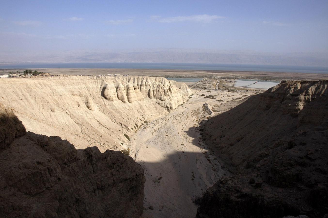
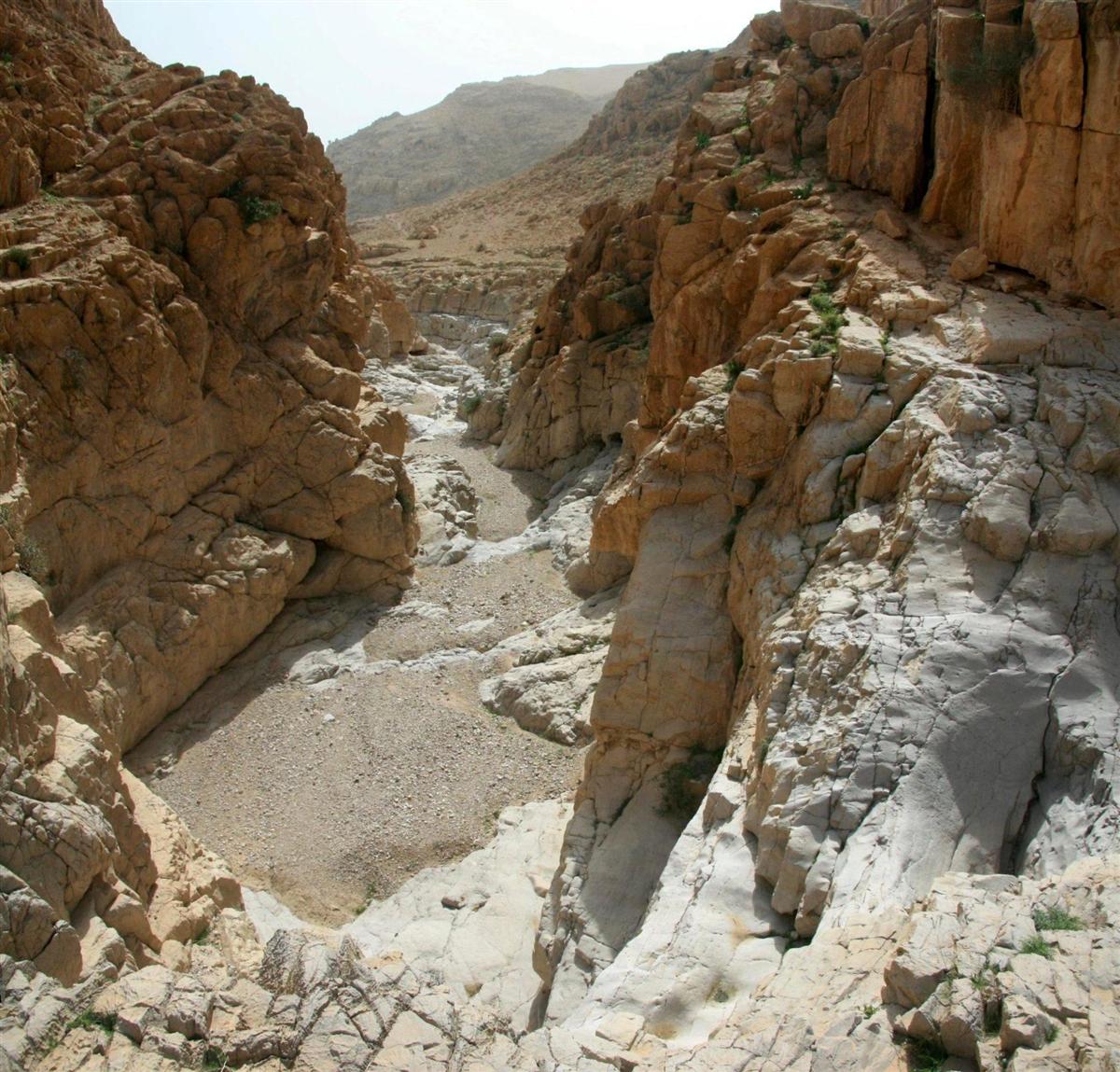
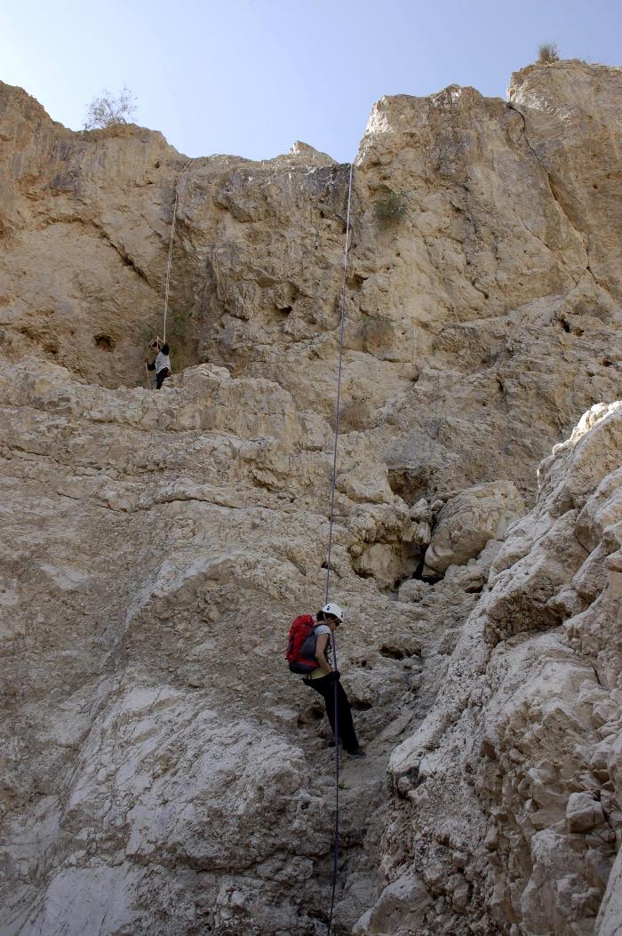
A view
from the 4th dry fall rappelling
station.
The route type:
Rappelling trip.
It is pretty interesting and diverse
route suitable to learn beginners but for this reason it is very overcrowded on
weekends. There are lots of large organized groups all the year round. Despite the fact that
all rappelling stations equipped with more than one station be prepared for
waiting in a queue…
The canyon is dry all the year round but be wary about floods during winter rains.
All rappelling
stations are equipped with anchors (Glue-in bolts). *
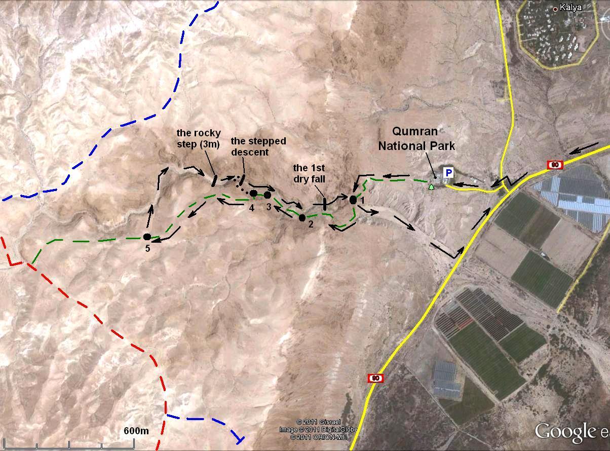
The canyon can be divided into two
prominent parts: upper and lower. The upper canyon includes dry falls 1-3 and
the lower canyon - 4-6. You can do any of them separately or both as a whole.
Any of the dry falls of the upper
canyon can be bypassed!
Getting there:
Drive on the road number 90 along Dead
Sea to the south.
Between
Leave your car at the national park's
parking lot. The entrance to the park requires payment, but as for 2011 it was
free of charge to pass through the park to the start of the rappelling route.
The canyon can be divided into two
prominent parts: upper and lower. The upper canyon includes dry falls 1-3 and
the lower canyon - 4-6. You can do any of them separately or both as a whole.
This description is for the whole route.
Follow a marked trail (green marks) that
crosses nahal Qumran just at the point dividing the
canyon into lower and upper parts (Point 1 on the map). Here you can
either to start rappel the lower part of the canyon or to climb with the trail
on the south slopes of the upper canyon to the main plateau.
There are four options to enter into the
upper canyon and they are described below in the natural consequence as you
would come across them while going on the trail:
Point 2
GPS: 31º 44' 24.5"N;
35º 27' 07.6"E
Trail map (black grid): 127.56; 193.00
It is the shortest and the easiest way to
start the rappelling trip: while on the canyon floor you should walk 100m only
to reach the 1st dry fall rappelling station. There are no obstacles on the
way.
Point 3
GPS: 31º 44' 27.6"N;
35º 27' 00.1"E
Trail map (black grid): 127.66; 192.80
Go down the gentle slopes to the canyon
floor. There are 400m to the 1st dry fall rappelling station. Easy down
scrambling is involved.
Point 4
GPS: 31º 44' 27.9"N;
35º 26' 57.8"E
Trail map (black grid): 127.67; 192.74
An old trail branches from the "green"
trail and leads into the canyon. Immediately after coming to the canyon floor
(500m before the 1st dry fall) you should negotiate some stepped descent. At
first sight it looks fearful but can be down climbed quite easily. More easy down scrambling is involved till the 1st
rappelling station.
Point 5
GPS: 31º 44' 21.0"N;
35º 26' 39.3"E
Trail map (black grid): 127.45; 192.25
It is the longest and most adventurous
way that involves negotiating some 3m rocky step. A short rope is required but
no obvious options for anchoring are found above the step.
This description is for the longest
version of the trip.
|
|
|
|
|
|
|
|
|
|
Route description:
|
|
|
|
|
|
|
|
|
|

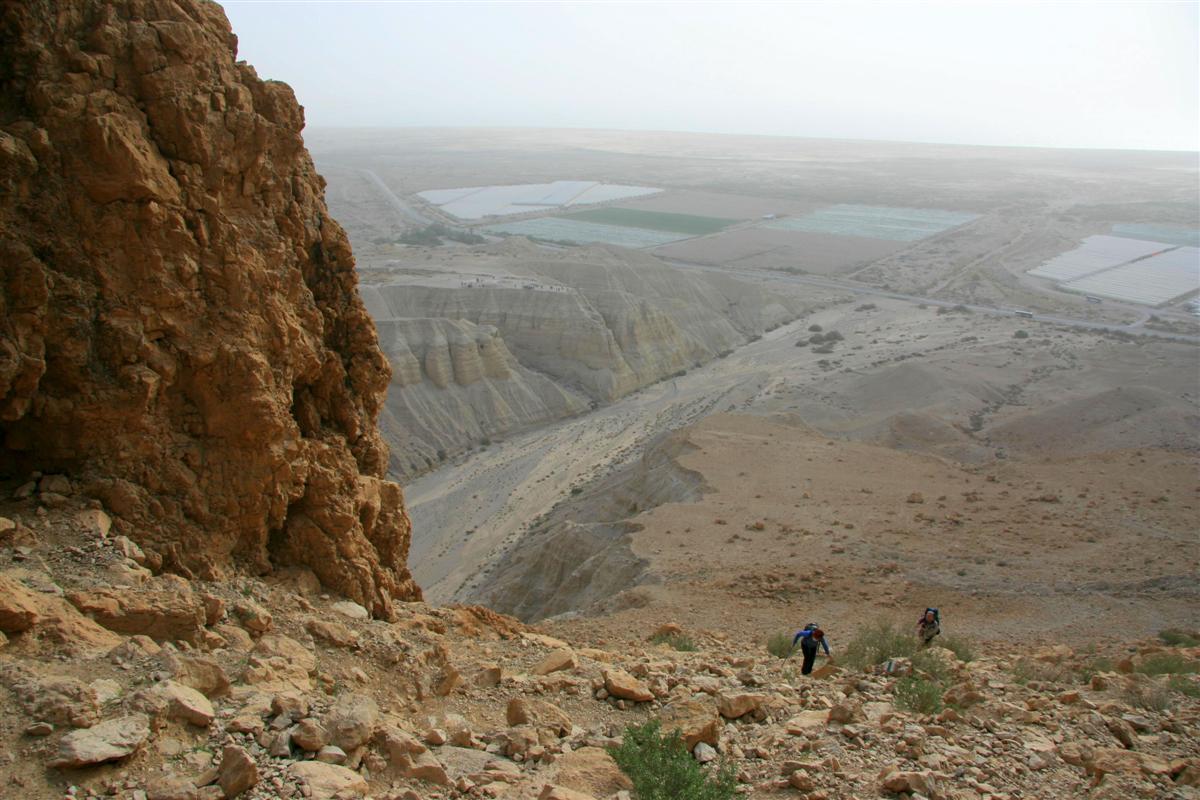
After 500m of easy
walking in the canyon (starting from Point 5!) you come across a 3m high dry fall that is very not
convenient for down climbing. There is no convenient option for anchoring!
Nevertheless, for those fellows that prefer to keep their legs unbroken I would
recommend to use a rope for the first descending participant at least.
A short walk from the foot of this rocky
step brings you to some stepped descent. At first sight it looks fearful but
can be down climbed quite easily. More easy down
scrambling is involved till the 1st rappelling station.
Remember that all the difficulties
described above are a bonus only for those groups starting from Point 5!
You can bypass all of them starting
from Point 1 or 2.
|
|
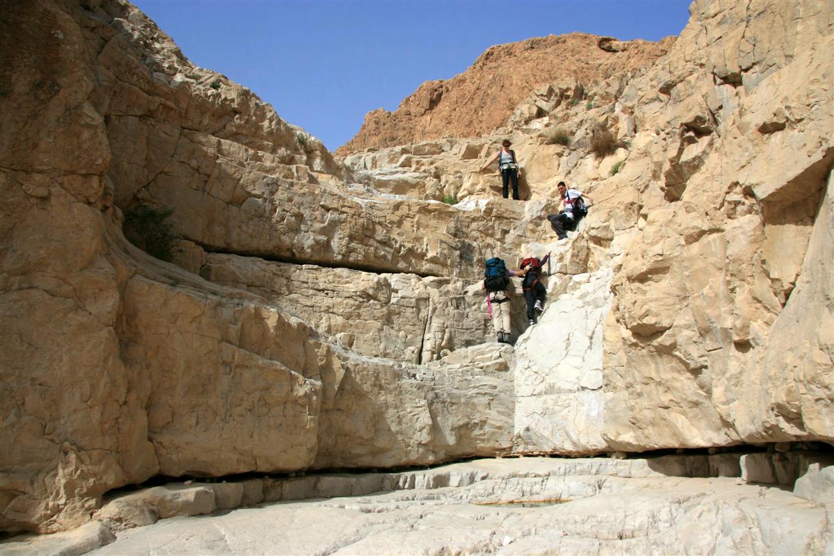
Climbing up the “green” trail |
|
Point 4. An old trail leads to the canyon floor |
|
Point 5. The start point of the longest version |
|
|
|


|
|
The 3m high rocky step |
|
A view from the stepped descent |
|
A view from the stepped descent |
|
|
|
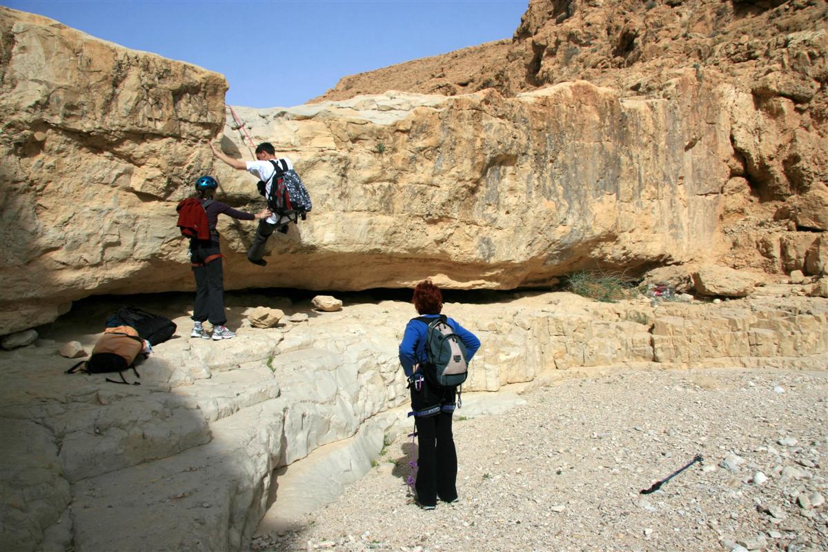
There are 6 dry falls to be abseiled:
1.
25m (30m from the station)
3-
|
|
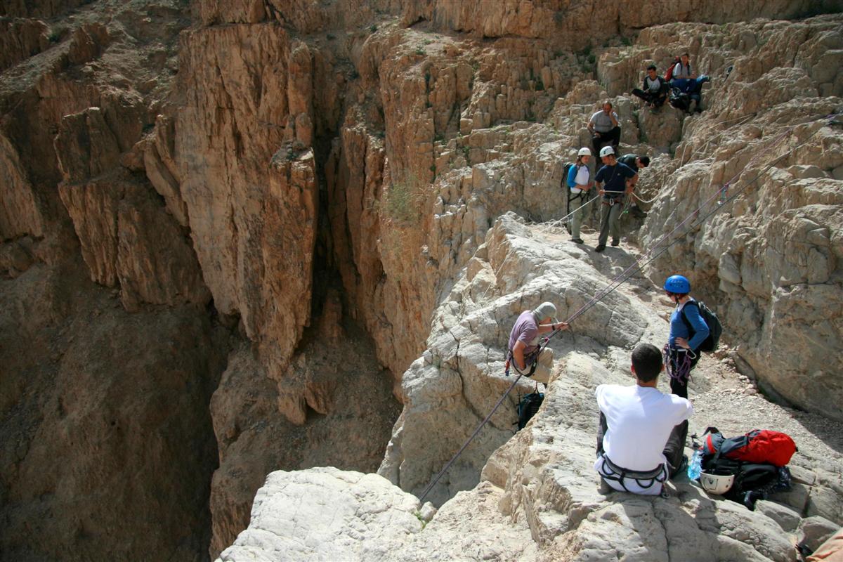
The 1st dry fall rappelling station |
|
A view from the 1st dry fall rappelling station |
|
|
|
|
|
|
|
Rappelling from the 1st dry fall |
|
Rappelling from the 1st dry fall |
|
The 1st dry fall |
|
|
|

2. 15m (measured from the station) - sloped.
|
|
The 2nd dry fall rappelling station |
|
Rappelling from the 2nd dry fall |
|
Rappelling from the 2nd dry fall |
|
|
|


The 3rd rappelling station is right at
the foot of the 2nd dry fall.
3. 36m (43m from the
station) - vertical.
|
|
The 3rd dry fall rappelling station |
|
A view from the 3rd dry fall rappelling station |
|
|
|
|
|


|
|
Rappelling from the 3rd dry fall |
|
Rappelling from the 3rd dry fall |
|
The 3rd dry fall |
|
|
|


A short walk and one stepped descent that
involves easy down climbing will bring you to the end of the upper part of the canyon
and at the same time to the 4th rappelling station. From here you can either to
return to the parking lot or to continue your rappelling trip into the lower
part of the canyon.
Pay attention that unlike the upper
canyon you cannot exit from the lower one until you will touch its floor at the
foot of the last dry fall.
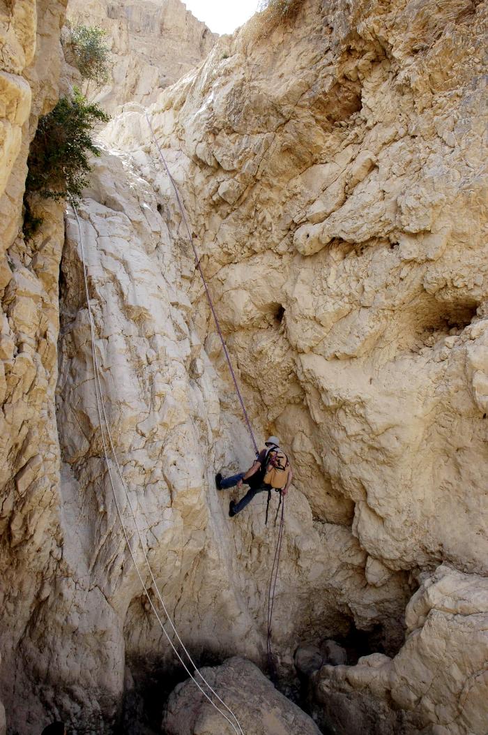
4. 34m (39m from the station) – vertical with ledges.
|
|
The down climbing before coming to the 4th rappelling station |
|
The 4th dry fall rappelling station |
|
Rappelling from the 4th dry fall |
|
|
|


|
|
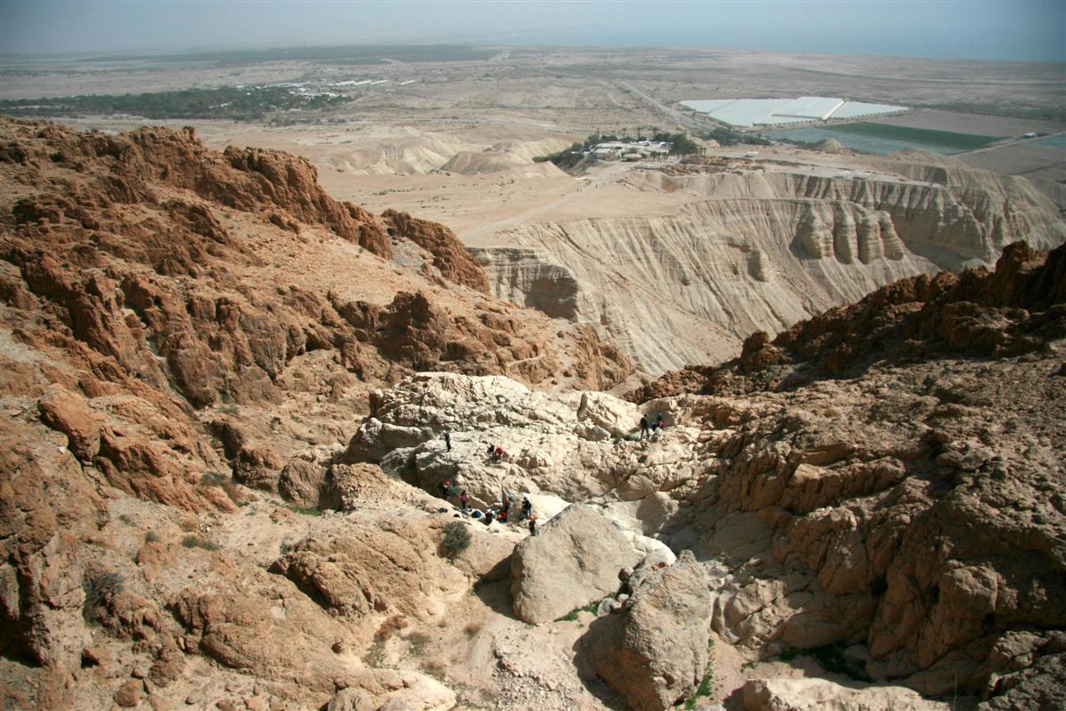
Rappelling from the 4th dry fall. The 5th and the 6th rappelling stations are in view |
|
The 4th dry fall |
|
Rappelling from the 4th dry fall |
|
|
|


5. 3m -
vertical.
|
|
A view from the 5th dry fall rappelling station |
|
Rappelling from the 5th dry fall |
|
|
|
|
|


Series of ledges that skirt some small
pools will bring you to the 6th (and the last!) rappelling station.
6. 27m –
mostly vertical with a ledge after 7-10m.
|
|
The 6th dry fall rappelling station |
|
Rappelling from the 6th dry fall |
|
|
|
|
|


|
|
Rappelling from the 6th dry fall |
|
Rappelling from the 6th dry fall |
|
The 6th dry fall |
|
|
|


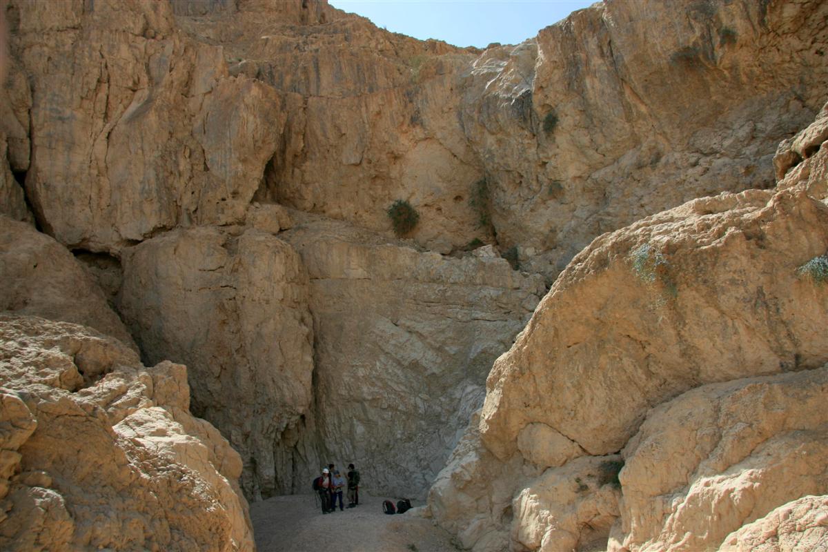
Walk down the wide canyon bed for 600m to
the main road and then continue to the parking lot at the National Park’s
entrance.
***** - The only one of its kind. A "must
do" trip!
****
- Very interesting, highly recommended!
*** - Pretty nice
route.
** - Inexpressive
one.
*
- Do it if you have nothing to do...